


二手航海用書暨筆記販售_Maritime Books and Navigation Note sell
2022年2月1日 星期二
二手航海用書暨筆記販售
資訊將不定期更新
也歡迎來信詢問需要類科的筆記或參考用書
本站將優先販售
以下如須購買,請先私訊,我再來開賣貨便。
以下所有書籍請點7-11賣場
1.臺灣燈塔專輯(二手) 2022/6/3
2.船舶穩度 原文書《Ship Stability for Masters and Mates 6e》2011 (二手) | 2022/6/9
3.貨物作業 我國航輪教材編撰計畫 教育部出版(2010年6月修訂二版) (二手) | 2022/8/26
4.應急程序 周和平 倫悅企業有限公司出版(2010年9月修訂一版) (二手) | 2022/8/26
5.求生技能與艇筏操縱 周和平編譯 國立臺灣海洋大學海運研究中心 出版(2010年3月二版) (二手) | 2022/8/26
-------------------------------------------------------------------------------------
以下已售出
1.實用造船學 大中國圖書有限公司 (2007年3月版)(二手) | 蝦皮購物 (shopee.tw) 已售出 2022/6/9
2.地文航海學 周和平 周氏兄弟出版(2009年8月二版) (二手)含航海教學用表 | 蝦皮購物 (shopee.tw)_已售出2022/07/23
含229表及航海曆 已售出 2022/05/28
6.海上污染防治 曾福成 出版(2012年9月再版) (二手) | 蝦皮購物 (shopee.tw) 已售出2022/6/4
7.操船學 蔡坤澄 倫悅企業有限公司出版(2010年9月修訂一版) (二手) | 蝦皮購物 (shopee.tw) 2022/8/26 已售出
104 關務人員五等考試- 船舶駕駛-航行當值大意-詳解
2018年3月17日 星期六
目前僅有101-108年詳解如下
1~8、20、25~30請參照避碰規則
9.應再利用海圖及聲納比對測深
10.優先考慮人員多寡及運用
11.大小比例尺海圖都需具備
12.來源: https://www.marineinsight.com/guidelines/masters-standing-and-night-orders/
->add specific points to the withstanding standing orders.
->All seafarer’s are familiar with the term “The Master’s word is final”.duly signed by every OOW
->Duly signed by every OOW. Every OOW should also remember that he signs the orders at the bottom, clearly adhering to a clause that very candidly binds him to it, stating “Please sign below, indicating that you understood these orders, which will be supplemented by the Master’s Night Orders each night when the vessel is at sea or at anchor or when required.”
*OOW- Officer of the Watch
*Click here for sample of Master’s Night Orders
13.能見度量表

14.
15.轉向完才能交班
16.接近陸地水深較淺,可藉由測深儀定位。
17.需通知船副,並依船副指令。
18.當天候狀況不良時,即能見度受限制時,造成目視無法清楚判斷,需搭配雷達與ARPA輔助瞭望。
21.22.參照STCW
23.每次當值
24.報告須精簡
->Detecting and reporting on ships, shipwrecks, debris, shipwrecked person, and other navigational hazards.
->Reporting on possibilities of collision, stranding, and other dangers to navigation.
來源:https://www.marineinsight.com/careers-2/what-are-the-duties-of-a-ships-lookout/
31.

32.威廉遜迴轉法
33.
如遇險人員在被救前已有長時間無進食,應將補充飲料濃度調低,
並根據遇險者體質及恢復情況逐漸提升牛奶和糖水濃度。
來源:https://www.cga.gov.tw/GipOpen/wSite/ct?xItem=83759&ctNode=9011&mp=9997/
34.

我國稱為約最低低潮面(Approximate Lowest Low Water),如圖一所示;而我國高度基準面多由平均海面算起,其採用標準與單位,在標題內均有標名之。高度在海面加以括弧,表示與深度有別。
來源:http://meda.ntou.edu.tw/martran/?t=3&i=0045
35.This is the best place to land

來源:http://www.seasources.net/PDF/PUB102.pdf
36.http://navg.tumt.edu.tw/files/16-1002-17405.php?Lang=zh-tw
38.進行緊急應變滅火時,確保人員人生安全器材的可用性
40.顯示霧號(Fog Signal: Vessel Aground in Restricted Visibility)
44.
(A)紅色(B)兩 臂 左 右 外 伸 , 緩 慢 上 下 重 覆 揮 動 之 ;(C)N.C
46.
46.
47.

105 關務人員五等考試- 船舶駕駛-航海駕駛-詳解
2018年3月13日 星期二
目前僅有101-108年詳解如下
1.

海圖最常使用的圓筒投影為麥氏投影(Mercator Projection),(緯度越高,漸長比例越大),也就是緯度越高,失真越大,所以當你用低緯度的比例尺去量取高緯度的距離時,所量取得到的距離會比實際來得大
3.
4.

第一行Geographic Location:地理名稱
第三行Chart Projection:投影方式
第四行Scale:比例尺
最後一行Chart Datum:海圖基準面
FROM:https://www.skippertips.com/members/409.cfm
5.
6.
C=323∘,D=4.5∘W,M,V=3.5∘E,T=?∘東加西減
T =323-4.5+3.5=322∘
7.

(A)磁差variation:灰色
(B)推薦航路Recommended Route:?
(C)玫瑰風圖Wind Rose:

8.IALA-A左紅右綠
IALA-B左綠右紅
9.
10.
G向西130度至天體,L=165∘


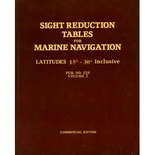
229表 第3冊 30~45度 下載 Pub No. 229 Vol 3 DOWNLOAD
2016年10月11日 星期二
Pub No. 229 Vol 3 : Sight Reduction Tables for Marine Navigation Latitudes 30-45 Inclusive
http://www.mdschool.com/HO229Vol3.pdf
http://msi.nga.mil/NGAPortal/MSI.portal?_nfpb=true&_pageLabel=msi_portal_page_62&pubCode=0013
http://www.mdschool.com/HO229Vol3.pdf
http://msi.nga.mil/NGAPortal/MSI.portal?_nfpb=true&_pageLabel=msi_portal_page_62&pubCode=0013

訂閱:
文章 (Atom)


關於站長
